test
2021
The Worst
Flooding Since
1948
A Major Event
I was going to fill a page with photos and information about the
flooding, but there are some really comprehensive, informative and
well-written sources available.
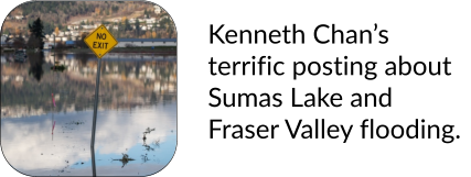
At right, I’ve linked to a post written by Kenneth Chan and posted by
Daily Hive, is a terrific source with photos and maps that thoroughly
clarify the history leading to the 2021 flooding.
Regarding this recent flooding, reporting by CTV news, also linked
at right, includes an excellent video and satellite images.
We Were Fine
As for us, we remained dry. Whereas the Sumas Prairie is at or below
sea level, which is why the water has to be pumped UPWARDS to the
Fraser River, we at Chilliwack are about 3-4 meters higher. Though a
few streets had to be closed, and the heavy rainfall caused stress to
the city sewer system and a number of streets were closed, the only
problem we faced was that Chilliwack had become and island; we
were cut off from Abbotsford to the west, and Hope to the East.
My Epiphany
In the past, I was mildly concerned because we are living on a flood
plain; however, now I realize that we might actually be in a better
location because we are on a flood plain: we’re behind a system of
dikes.
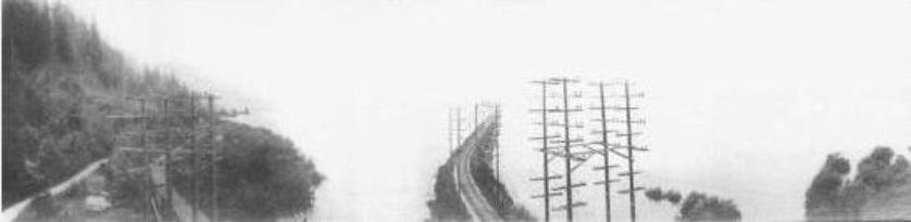
It was only a short time ago that I learned about the history of
Sumas Prairie. Until then, the reason why the railroads were built 3
meters above the surrounding land was a mystery to me. Now I
know that the electric train running from Vancouver to Chilliwack
used to travel across the shallow lake for many kilometers.
Yeah, an electric train crossing acres of water.


Links


Home | Return to the Year Index | Next Page